Search Results
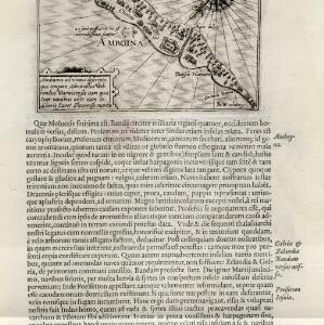
Amboina ad viumu descripta quo tempore Admiarallus Wibrandus Warwicensis cum quatuor nauibus ante eam in achoris staret a 1599 mese martio
1614
Indonesia
The Latin title of this map refers to an Admiral Wibrand of Warwick, who visited the island of Amboina (Ambon Island in the Maluku Islands) in March 1599.
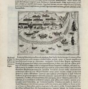
[View of the island of Ternate with the town Gamme Lamme]
1614
Indonesia
Two drawings and text from ‘Rerum et urbis Amstelodamensium historia’ by Johannes Pontanus: the port and town of Gamme Lamme on the island of Ternate, with local and European vessels; and a naval battle between Dutch and Portuguese ships.
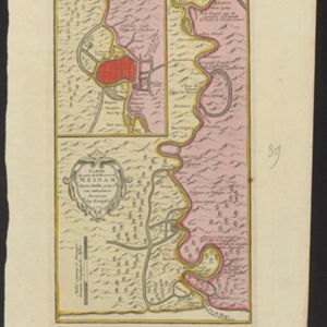
Carte du cours de la Riviere de Meinam: depuis Judia jusqu'à son embouchure
1730
Thailand
Map of the Meinam (Chao Phraya) river from the city of Judia (Ayutthaya) to its mouth near Bangkok. Features temples, villages, a Bishop's Palace, a fort at Bangkok, and a ‘Champ des Eléphans [Elephant Field]’. The text is in French and Dutch.

Carte des environs de Batavia = Kaart van de buitenstreeken van Batavia
c.1772-1780
Indonesia
This late 18th century map of Batavia (Jakarta) focusses on the network of canals and rivers surrounding the city, as well as the many fields and plantations, including rice fields (‘Champ de Ris’) and sugarcane (‘Cannes de Sucre’).

Kaart van een Gedeelte der Kust van Cochin-China, met de baai en haven van Turon, en het eiland Kal Lao
1793
Vietnam
A map to aid navigation around the Bay of Turon (location of modern city of Da Nang, Vietnam). Bathymetry (sea depth) is marked, as is the route of the Dutch ship ‘Jackaij’ on her departure from the bay. An elevation view of the land is shown below.
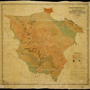
Geognostisch-mijnbouwkundige kaart van het eiland Bangka, distrikt Blinjoe
1872
Indonesia
A geological map showing the types of rock and minerals found in Blinjoe district on the island of Bangka, off the east coast of Sumatra. Deposits of iron, quartz and tin are marked, and coral is shown at the coast.


