Search

Search Results

Kaart van Straat Soenda

event1883

location_onIndonesia

The coloured areas on this map indicate the coastal regions that flooded after the 1883 Krakatoa volcanic eruption. Krakatoa is shown in the centre of the Sunda Strait, between Sumatra and Java.

Het ingestorte terrein bij Krakatau

event1883

location_onIndonesia

A map of the effects of the 1883 Krakatoa volcanic eruption. The red line is the boundary of the collapsed area. Black numbers are sea depth before the eruption; red numbers are after. A line above a number means no ground found at that depth.

Kaart van een gedeelte van Straat Soenda ter berekening van de hoeveelheid uitgeworpen stoffen

event1883

location_onIndonesia

A map showing the results of the 1883 eruption of the Krakatoa volcano. Black numbers indicate sea depth before the eruption; red numbers are after.

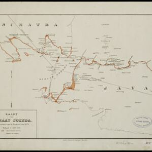
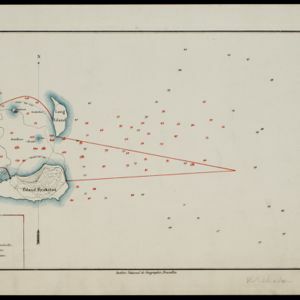
Kaart van Krakatau en omliggende eilanden

event1883

location_onIndonesia

A map of the effects of the 1883 Krakatoa volcanic eruption. The orange line is the islands’ outline pre-eruption; the red line is the boundary of the collapsed area. Red numbers are sea depth. Pre- and post-eruption sizes of the islands are listed.