Search

Search Results

Route chart to India and the East

event1895

location_onBrunei, Cambodia, East Timor, Indonesia, Laos, Malaysia, Myanmar, Philippines, Singapore, Southeast Asia, Thailand, Vietnam

Map of Asia featuring steamship routes—including around Southeast Asia—connecting ports such as Penang, Singapore, Batavia (Jakarta), Saigon, Bangkok, Rangun (Yangon), Manila, Macassar (Makassar) etc. There is also an inset map of Singapore.

Map to illustrate the Siamese question: showing the present limits of French claims, and the additional territory now demanded

event1893

location_onCambodia, Laos, Malaysia, Myanmar, Thailand, Vietnam

Map highlighting areas of eastern Siam (Thailand) claimed by France. Notes describe Siam’s geography, government, population, military and trade (rice, teak, pepper, bullocks, fish, hides, tin, cardamom, tin), including trading partners by tonnage.

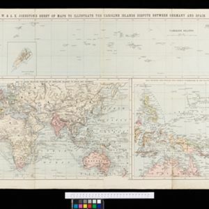
W. & A.K. Johnston's sheet of maps to illustrate the Caroline islands dispute between Germany and Spain

event1885

location_onSoutheast Asia, Papua New Guinea, Indonesia, Philippines, Malaysia, East Timor

Three maps of the Caroline Islands. One shows colonised areas in Southeast Asia: Dutch East Indies; British North Borneo, British New Guinea; German New Guinea; Philippines (Spain); Portuguese Timor. The route of the Challenger expedition is marked.

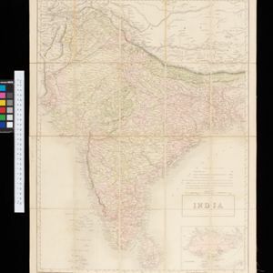
India

event1847

location_onSingapore, Malaysia

There is an inset map of the island of Singapore on this map of India. The island is coloured red to indicate it is British colonial territory. The surrounding islands and straits are marked, as well as details of the city such as the Sultan Mosque.

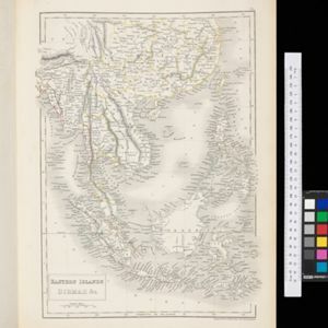
Eastern Islands: Birmah &c.

event1846

location_onBrunei, Cambodia, East Timor, Indonesia, Laos, Malaysia, Myanmar, Philippines, Singapore, Southeast Asia, Thailand, Vietnam

On this map of Southeast Asia, British colonial territory is highlighted within red borders: the Straits Settlements (Singapore, Malacca and Penang) on the west coast of the Malay Peninsula; and British Burma (Chittagong and Aracan, and Tenasserim).

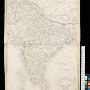
India

event1846

location_onSingapore, Malaysia

There is an inset map of the island of Singapore on this map of India. The island is coloured red to indicate it is British colonial territory. The surrounding islands and straits are marked, as well as details of the city such as the Sultan Mosque.

close

  • Filter from 1846 to 1895

Current results range from 1846 to 1895