Search

Search Results

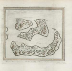
Iles de Banda

event1780

location_onIndonesia

Map of the Banda Islands—which was at this time the only source of nutmeg in the world—featuring mountains, plantations, settlements and a military fort. On the island of Gunnanapi (Banda Api) a volcano erupts (‘api’ means ‘fire’ in Indonesian).

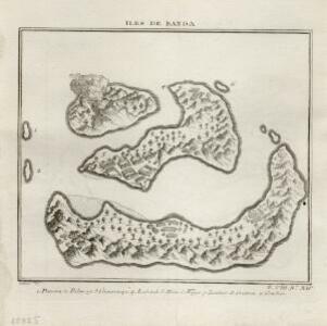
Iles de Banda

eventc.1746-1770

location_onIndonesia

Map of the Banda Islands—which was at this time the only source of nutmeg in the world—featuring mountains, plantations, settlements and a military fort. On the island of Gunnanapi (Banda Api) a volcano erupts (‘api’ means ‘fire’ in Indonesian).

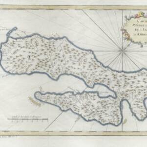
Carte particuliere de l'isle d'Amboine

eventc.1746-1770

location_onIndonesia

A mid-18th century map of the island of Amboine (Ambon Island in the Maluku Islands of modern Indonesia), featuring mountains, rivers and paths. Other notable highlights include a ruined castle, a guardroom, and houses.

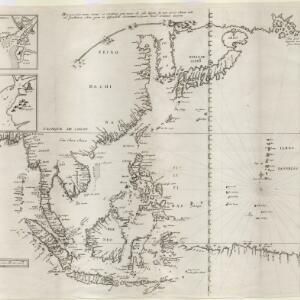
[Map of the East Indies]

event1666

location_onVietnam, Myanmar, Papua New Guinea, Philippines, Singapore, Southeast Asia, Thailand, Malaysia, Laos, Indonesia, East Timor, Cambodia, Brunei

This mid-17th century map of Southeast Asia has a maritime focus, with shoals and reefs, and the coastal areas marked in great detail, while the interiors remain mostly blank. The Great Wall of China can be seen at the top of the map.

close

  • Filter from 1666 to 1780

Current results range from 1666 to 1780