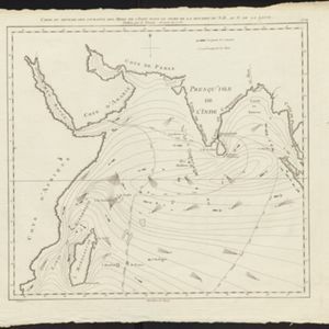
Carte des courants pour le tems de la Mousson du S.O., au N. de la ligne
c.1780
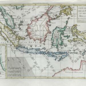
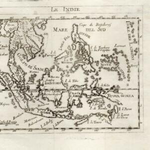
Malaysia, Indonesia, Myanmar, Thailand
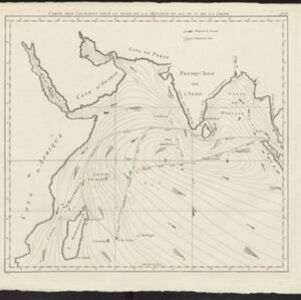
Map of the Indian Ocean showing the currents (represented by arrows) and winds (represented with letters A to F) during the monsoon seasons. Three routes—one old and two new—from the Isle de France (Mauritius) east to the Strait of Malacca are shown.