Search

Search Results

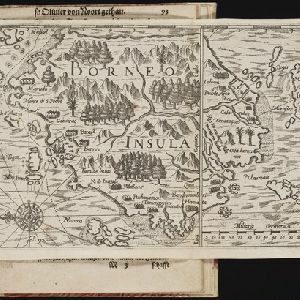
Borneo Insula

eventc.1600-1699

location_onMalaysia, Indonesia

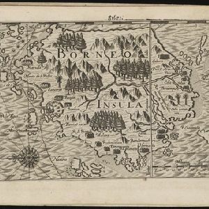
An early map of the island of Borneo, depicting the natural landscape of mountains, forests, rivers and shoals, and also evidence of human habitation with houses representing settlements, and a port and shipping route along the northern coast.

Borneo Insula

event1602

location_onMalaysia, Indonesia

An early map of the island of Borneo, depicting the natural landscape of mountains, forests, rivers and shoals, and also evidence of human habitation with houses representing settlements, and a port and shipping route along the northern coast.

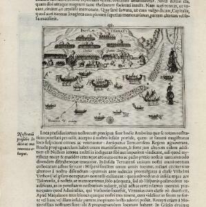
[View of the island of Ternate with the town Gamme Lamme]

event1614

location_onIndonesia

Two drawings and text from ‘Rerum et urbis Amstelodamensium historia’ by Johannes Pontanus: the port and town of Gamme Lamme on the island of Ternate, with local and European vessels; and a naval battle between Dutch and Portuguese ships.
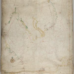
[Zuid-Chinese Zee]

event1686

location_onIndonesia, Malaysia, Thailand, Cambodia, Vietnam

Early navigation map of the South China Sea. The web of lines is a rhumbline network, while the numbers indicate sea depth (bathymetry), both used to aid navigation. A route around the Gulf of Thailand is marked with text and the dates 1643 and 1644.
't Groodt Timoor

eventc.1700-1899

location_onEast Timor, Indonesia

Map of Timor with Dutch and Portuguese flags marking military forts. Details are represented pictorially e.g. villages by small houses, forests by trees. There are extensive handwritten annotations, with some text translated from Dutch to French.

Borneo Insula

event1706

location_onMalaysia, Indonesia

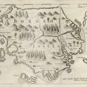
An early map of the island of Borneo, depicting the natural landscape of mountains, forests, rivers and shoals, and also evidence of human habitation with houses representing settlements.

Kaart van het Eyland Bali

event1726

location_onIndonesia

On this map of Bali (and parts of Java and Lombok), mountains, trees, fields and settlements are shown pictorially. The coasts are marked with shoals (dots), reefs (crosses), bathymetry (sea depth, in figures) and anchor points (anchor symbols).

Das eyland Baly oder klein Java

event1750

location_onIndonesia

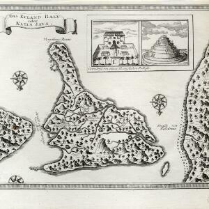
Amongst the mountains and jungles of mid-18th century Bali, this map shows three royal palaces, walled encampments, towns, and seven Buddhist temples (or ‘stupa’) on the east coast. Inset illustrations depict a palace and a temple in detail.

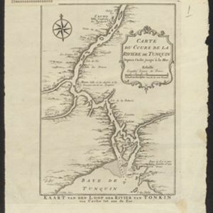
Carte du Cours de la Riviere de Tunquin: depuis Cacho jusqu'à La Mer

event1755

location_onVietnam

Map of the Tunquin River (Red or Hong River) from the city of Cacho (Hanoi, Thailand) to its mouth. At the mouth, bathymetry (sea depth), shoals and anchor points are marked. A place named Hean is labelled as an English and French trading post.

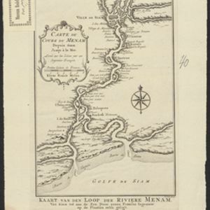
Carte du Cours du Menam: Depuis Siam Jusqu à la Mer

event1755

location_onThailand

Map of the Menam River (Chao Phraya River) from the city of Ayutthaya (labelled ‘Ville de Siam’), past Bangkok to its mouth in the Gulf of Thailand. Features forts, villages, and a royal palace along the route.

close