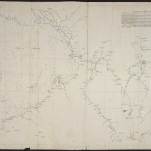
Carte de la Côte de Pégou, et de celle de Martaban
1775
Myanmar
Navigation map of the coast of the ancient kingdom of Pégou and near the town of Martaban (Mottama), Myanmar. Bathymetry (sea depth), anchor points, notes on currents and obstructions are marked, and there are drawings of side views of coastal hills.