
Search Results
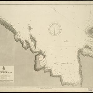


Oostkust: Aroe-Eilanden / Ankerplaats voor Watoelei en Koemoel
1896
Indonesia
Map of the east coast of the Aru Islands (Maluku Islands), with bathymetry (sea depth), tides and currents, shoals and other obstructions. An inset map shows the anchorage at islands off the coast, along with elevation views of the islands.

Ankerplaatsen en mondingen van rivieren op de Noord- en Oostkust van Sumatra: Blad I
1896
Indonesia
Eleven separate maps of bays and river mouths of Sumatra, including two bays on the island on Bras (Breueh Island), and the bay at Kota Radja (Banda Aceh). Bathymetry (sea depth), anchor points, reefs and shoals are marked, along with tide data.

Vaarwaters en ankerplaatsen op de oostkust der Aroe-eilanden
1896
Indonesia
Four navigation maps of the waterways and anchorages around the east coast of the Aru Islands (in the Maluku Islands, near New Guinea). Bathymetry (sea depth), shoals and other obstructions are shown, with trees and villages to use as landmarks.

Vaarwaters en ankerplaatsen op de Zuidkust van Celebes
1896
Indonesia
Eight navigation maps from around the south coast of Celebes (Sulawesi). Anchorages, roadsteads (bodies of water sheltered from tides/currents), bathymetry (sea depth), shoals and other obstructions are shown, with hills and settlements as landmarks.


Moluksche archipel: Baai van Amboina
1895
Indonesia
A map to aid navigation in Ambon Bay, on the island of Ambon in the Maluku Islands: bathymetry (sea depth) and mountains are shown along the coasts, with inset maps of a coal mine pier and Fort Victoria. A second map updates the coal mine pier map.


