Search Results
82 Results found
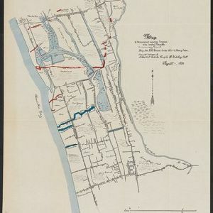
Map of the Spanish and American trenshes on the south of Manila
c.1900-1909
Philippines
Created by the U.S. Army during the Spanish-American War, this reconnaissance map of a small area south of Manila features Spanish (red) and American (blue) trenches, as well as roads, buildings and ground conditions (firm ground, swamps, fields).

Map of the Kingdom of Siam and its dependencies
c.1900
Myanmar, Malaysia, Singapore, Thailand, Laos, Cambodia, Vietnam
The border of the Kingdom of Siam (Thailand) and its internal administrative districts are highlighted in yellow. Inset maps show the cities of Bangkok, Chiengmai (Chiang Mai) and Luang Pra Bang (Luang Prabang) in more detail.
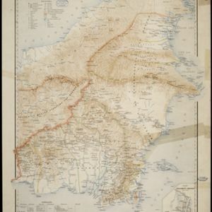
Kaart der residentie Zuider- en Ooster-afdeeling van Borneo
1899
Indonesia
On this map, the residency of South and East Borneo is divided into departments (green borders) and provinces (yellow borders). There is an inset plan of the city of Banjarmasin, with rivers, buildings, residential areas, roads and crops marked.
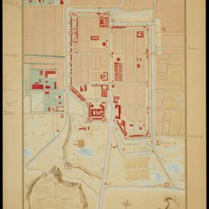
Copie no. 2: Plan van den stadt en het casteel van Batavia met een gedeeltevan deszelfs voorsteeden en verdere buijtenplaatse ao 1762
1898
Indonesia
A hand-drawn and coloured plan of the important port city of Batavia (Jakarta), with a detailed legend identifying parts of the city, castle and suburbs. Handwritten notes around the border give the names of roads. Copied from a 1764 map.
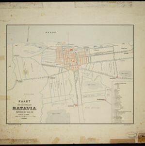
Kaart der hoofdplaats Batavia omstreeks het jaar 1740
1898
Indonesia
A mid-18th century map of the important port of Batavia (Jakarta), with military forts, a pier, hospitals, churches, and residential streets. However, the city is also surrounded by fields and plantations, for producing crops and grazing animals.
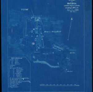
Kaart van Batavia omstreeks 240 jaren geleden overgebracht in 1864
1898
Indonesia
Although published in the 19th century, this is a copy of a much earlier map of Batavia (Jakarta) from c.1625. It focuses on the castle and fortifications, but also shows the fields of crops and wetlands surrounding the city.
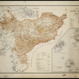
Kaart de residentie Wester-afdeeling van Borneo
1898
Indonesia
Topographical map of western Borneo, with inset maps of the islands off the west coast, and of the city of Pontianak including the docks and crops grown near the city (rice, coconut, mangosteen, sago, alang-alang, indigo plant, sugarcane, bamboo).

