
Search Results


Kaart van het gebied bezet in Groot-Atjèh
1898
Indonesia
A large-scale map of Groot-Atjceh, northern Sumatra, spread over six sheets, and featuring details such as routes, crops (rice, banana, sugarcane, alang-alang, bamboo), mountains and wetlands, and settlements (city of Kota Radja (modern Banda Aceh)).

Map of the Island of Singapore and its dependencies
1898
Singapore
Map of Singapore Island, divided into Districts, including the surrounding islands and straits. The city centre, roads and forests are marked. MacRitchie Reservoir is at the centre of the island, with coconut plantations along the east coast.


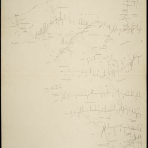
Kaart van het gebied bezet in Groot-Atjeh, met de nederzettingen Lepoeng en Lehoeng
1897
Indonesia
A map of Groot-Atjeh, Lepoeng and Lehoeng, at the northern tip of Sumatra, detailing routes (rivers, roads, railways), crops (rice, banana, sugarcane, betel, pepper, alang-alang, bamboo) and land features (forests, mountains, wetlands).


Atlas van Nederlandsch Oost-Indië
c.1897-1904
Indonesia
Very detailed atlas of the entire Dutch East Indies, over 16 map sheets, with a cover and overview map. Includes topographic maps, inset maps of cities and islands, and maps featuring land and sea routes, languages, geology, colonial territory etc.
- Filter from 1791 to 1900
- Port28
- Railway Station20
- Pier11
- River207
- Road187
- Path131
- Postal Route65
- Railway/Tramway65
- Canal24
- Telegraph/Telephone22
- Bridge21
- [remove]District/Administrative Border219
- Civic/Metropolitan Border29
- Colonial Possessions20
- National Border8
- Regional Border5


