Search

Search Results

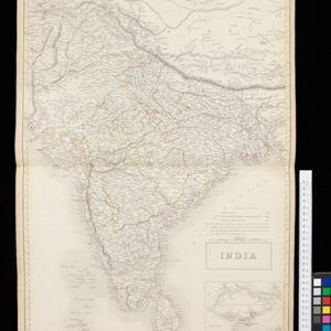
India

event1846

location_onSingapore, Malaysia

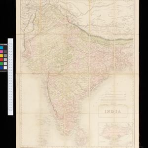
There is an inset map of the island of Singapore on this map of India. The island is coloured red to indicate it is British colonial territory. The surrounding islands and straits are marked, as well as details of the city such as the Sultan Mosque.

General-Karte von Mittleren Sumatra von Padang bis Singkel

event1847

location_onIndonesia

This map focuses on the mountain ranges along the west coast of central Sumatra. Military bases, post offices, villages, rivers and hot springs are also marked, and there are inset maps of the towns of Padang and Singkel (Singkil).
India

event1847

location_onSingapore, Malaysia

There is an inset map of the island of Singapore on this map of India. The island is coloured red to indicate it is British colonial territory. The surrounding islands and straits are marked, as well as details of the city such as the Sultan Mosque.

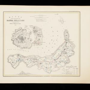
Kaart van de voornaamsten der Banda Eilanden

event1854

location_onIndonesia

Map of the Banda Islands, with a volcano on Goenong Api, two forts (‘Ft. Belgica’ and ‘Ft. Nassau’) on Neira, and a list of the heights of the mountains. (From ‘Algemeene Atlas van Nederlandsche Indie [General Atlas of the Dutch East Indies]’.)

Military cantonments: town and suburbs of Akyab, 1853-54

event1866

location_onMyanmar

Plan of British military installations in the port town of Akyab, Burma (Sittwe, Myanmar), featuring piers on the Kolladyne River (Kaladan River), hospitals, a work house, mission house, hotel, bazaar, burial grounds, religious buildings etc.
Kaart van Malang en Omstreken

event1882

location_onIndonesia

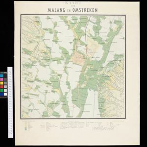
Map of the city of Malang, Java, featuring the railway station, military camp, hospital, market etc. The surrounding area has villages, rivers and crops: rice (paddy) fields, coffee, alang-alang, bamboo. Red numbers represent height above sea-level.

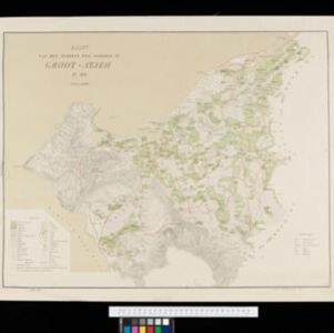
Kaart van het terrein des Oorlogs in Groot-Atjeh in 1876

event1883

location_onIndonesia

The Aceh War (1873–1904) between the Sultanate of Aceh and Dutch colonists is highlighted on this map of Groot-Atjeh in 1876. Flag symbols mark the locations of Dutch troops, while a red line records the route marched by ‘agitating troops’ in 1875-6.

Map of the Malay Peninsula

event1883

location_onMalaysia, Singapore

The Straits Settlements are in red, with the rest of the map marked with names of local peoples (‘Inhabited by the Johor Jakuns’) and resources (mines). Many areas are left blank or vague as unexplored or approximate. Inset map of Singapore city.

Singapore: Plan of harbour and roadstead

event1885

location_onSingapore

Plan of Singapore harbour, with wharfs and buildings. A roadstead—a body of water sheltered from tides/currents, for ships to anchor—is labelled ‘Singapore Road’. Islands, shoals and reefs are marked, as are roads and buildings in the city.

Sketch of Hué

event1885

location_onVietnam

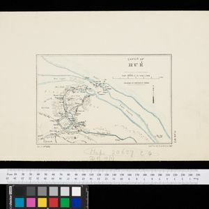
Map of the city of Hué (Huế) on the Perfume River, east coast of Vietnam. There are forts, villages and rice fields along the river. In the city, there is the royal palace within walls and a moat, French military barracks and other colonial areas.

The town of Singapore

eventc.1887-1888

location_onSingapore

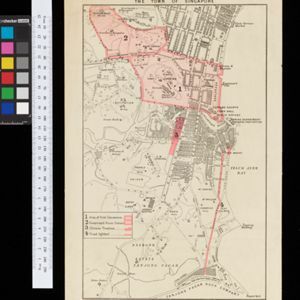
Plan of Singapore town, including Tanjong Pagar docks, the central civic/business area around the Singapore River, and residential areas. The Government House area (now known as The Istana), and areas of Chinese theatres, are highlighted.

close

  • Filter from 1846 to 1899

Current results range from 1846 to 1899