
Search Results

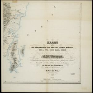
Kaart van het oude Bandjermasinsche rijk, Tanah Laut, Bekompai, Mengkatip, Siong en Patai, Kleine Dajak en Doesoen
1862
Indonesia
A map of the south-eastern tip of Borneo (modern South Kalimantan) spread over four sheets, featuring mountains, wetlands and rivers. Created by the Dutch colonial authorities, small flags mark fortifications of Dutch and auxiliary troops.


Kaart van de Oosterhelft der Residentie Palembang
1860
Indonesia
Map of the eastern half of the Dutch colonial administrative region (residency) of Palembang, Sumatra. A fort is marked in the town of Batoeradja. (From ‘Algemeene Atlas van Nederlandsche Indie [General Atlas of the Dutch East Indies]’.)

Kaart van de Oosterhelft der Residentie Timor
1860
Indonesia
Map of the eastern half of the Dutch colonial administrative region (residency) of Timor, with an inset map of its capital city and port Timorkoepang (Kupang). (From ‘Algemeene Atlas van Nederlandsche Indie [General Atlas of the Dutch East Indies]’.)


Kaart van assistent-residentie Patjitan
1859
Indonesia
Map of the residency of Patjitan (Pacitan), south coast of East Java, divided into administrative districts. At the base, there is an elevation (side view) drawing of terrain around the Bay of Patjitan. Villages, forts and ruined temples are marked.


- [remove]District/Administrative Border80
- Civic/Metropolitan Border26
- Colonial Possessions22
- National Border6
- Regional Border4


