
Search Results
257 Results found

Asia
1814
Brunei, Cambodia, Indonesia, Laos, Malaysia, Myanmar, Philippines, Singapore, Southeast Asia, Thailand, Vietnam
An early 19th century map, with the regions of Southeast Asia marked with coloured borders: Malaya is red, indicating it is part of the British Empire; the orange borders around Sumatra, Borneo and Celebes show they are part of the Dutch East Indies.
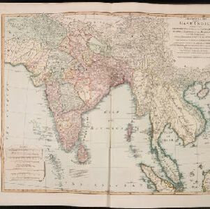
A New general map of the East Indies, exhibiting in the Peninsula on this side of the Ganges or Hindoostan, the several partitions of the Mogul's Empire
1823
Malaysia, Brunei, Indonesia, Cambodia, Thailand, Vietnam, Myanmar, Laos, Southeast Asia
This 19th century map highlights British colonial possessions in India (in red), and the various kingdoms of northern Southeast Asia, including the Birman Empire (Myanmar), Cochin China and Tonkin (Vietnam), Lao (Laos), Siam (Thailand), and Cambodia.
India (south part)
1824
Myanmar, Malaysia, Singapore, Thailand, Indonesia
The inset map on this map of India features part of mainland Southeast Asia: Pegu and the Tenasserim Provinces (Myanmar), Siam (Thailand), and the Malay Peninsula (Malaysia), with the Straits Settlements—Singapore, Malacca, Penang—highlighted in red.

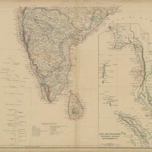
India (southern sheet)
1824
Myanmar, Malaysia, Indonesia, Singapore, Thailand
The inset map on this map of India features part of mainland Southeast Asia, with the British colonial territories—Straits Settlements, British Burma—highlighted in red, ‘protected states’ in yellow, and ‘independent states’ in green.

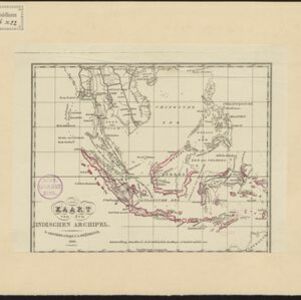
Carte du Grand Archipel d'Asie (Partie Nord-ouest de l'Océanie)
1826
Southeast Asia, Malaysia, Indonesia, Vietnam
Colonial possessions of the Dutch, Spanish and Portuguese, as well as lands of ‘indigenous princes’ are marked with coloured borders on this map of maritime Southeast Asia. Hot springs and mineral water springs in Java are also listed.

Carte de l'ile de Java et des autres possessions orientales du Royaume des Pays-Bas
1830
Indonesia, Malaysia, Philippines, East Timor, Singapore
A French map of the Asian colonial possessions of the Netherlands (Dutch East Indies), with an inset map of the island of Java. Colonies of Britain (Malay Peninsula), Spain (the Philippines) and Portugal (parts of Floris and Timor) are also marked.

Die Ostindischen Inseln
1830
Brunei, Cambodia, East Timor, Indonesia, Laos, Malaysia, Myanmar, Philippines, Singapore, Southeast Asia, Thailand, Vietnam
Map of Southeast Asia highlighting European colonial possessions. Unusually, the south coast of the Philippine island of Mindanao is shown twice, reflecting uncertainty about its true location. Names of indigenous peoples are listed on Borneo.
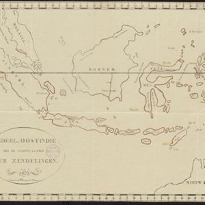
Kaart van den Indischen Archipel
1830
Brunei, Cambodia, East Timor, Indonesia, Laos, Malaysia, Myanmar, Philippines, Singapore, Southeast Asia, Thailand, Vietnam
This map shows the Dutch colonial possessions or dependencies in the East Indies during the early 19th century. Areas not coloured red remained under local rulers or were colonies of other European powers.
- Filter from 1680 to 1900
- Indonesia190
- Malaysia171
- Singapore141
- Myanmar132
- Thailand122
- Brunei116
- East Timor108
- Vietnam97
- Philippines96
- Cambodia93
- Laos87
- Southeast Asia74
- more Simple Location »


