Search

Search Results

[Manuscript map of the Philippines]

event1650

location_onPhilippines

A mid-17th century hand-drawn map concentrating on the Philippine islands between Luzon and Mindanao. Many are named, and shoals and reefs marked around their coasts. The azimuthal projection of the map focuses at the center of the archipelago.

Carta secon[d]a generale del'Asia

event1646

location_onIndonesia, East Timor, Philippines

This mid-17th century map of the Philippines, Celebes (Sulawasi), Maluku Islands and New Guinea has some inaccuracies, particularly in the shape of Celebes and New Guinea. However, the many Philippine islands are portrayed relatively accurately.

Description of East India

event1625

location_onMyanmar

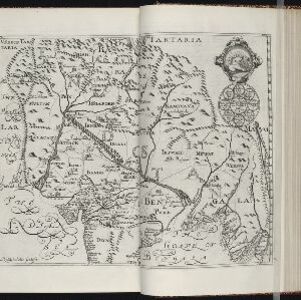
The city of Pegu (Bago, Myanmar), some other settlements, and a river named Martabam Auia are shown in the lower right of this 17th century map of Hindustan (Indian subcontinent). The genealogical seal of the Mughal emperors of India is top right.

Description de la coste septentrionale de Noua Guinea

event1618

location_onIndonesia

The north coast of New Guinea is mapped here as it was discovered by the Dutch explorer Willem Corneliszoon Schouten. He is named on the map as Guillaume Schouten de Hoorn, known as the first to sail from Europe to the Pacific Ocean via Cape Horn.

Description de la grande mer du Sud monstrant par quel chemin Guillaume Schouten a navige

event1618

location_onIndonesia, Papua New Guinea

This map shows the route of the Dutch explorer Willem Corneliszoon Schouten, crossing the Pacific Ocean from South America to New Guinea. He was the first explorer to sail from Europe to the Pacific Ocean via Cape Horn.

Description de la coste septentrionale de Noua Guinea

event1618

location_onIndonesia

The north coast of New Guinea is mapped here as it was discovered by the Dutch explorer Willem Corneliszoon Schouten. He is named on the map as Guillaume Schouten de Hoorn, known as the first to sail from Europe to the Pacific Ocean via Cape Horn.

Asiae nova descriptio

event1612

location_onBrunei, Cambodia, East Timor, Indonesia, Laos, Malaysia, Myanmar, Philippines, Singapore, Southeast Asia, Thailand, Vietnam

This early 17th century map features a number of mythical lakes that were once thought to exist in southern China—including ‘Cayamay Lacus’—and which feed several rivers that flow south through mainland Southeast Asia.

India Orien

event1607

location_onBrunei, Cambodia, East Timor, Indonesia, Laos, Malaysia, Myanmar, Philippines, Southeast Asia, Singapore, Thailand, Vietnam

Early 17th century map of Asia, with annotations in Latin naming the major countries, islands and cities. Maritime Southeast Asia is shown as an archipelago of many small islands.

Insula Ternate

event1603

location_onIndonesia

This early 17th century map features a drawing of contact between Portuguese/Spanish colonialists and a local ruler. Set on the island of Ternate—one of the Moluccas or ‘Spice Islands’—it reminds us of the importance of the spice trade at this time.

close

  • Filter from 1550 to 1900

Current results range from 1550 to 1900