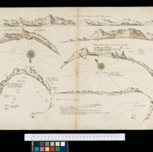
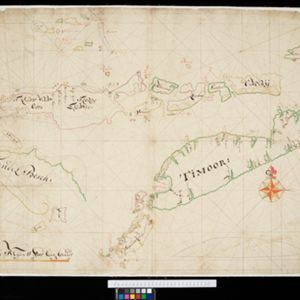
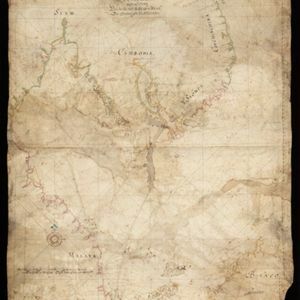
[Portolan chart of the South China Sea]
1701
Brunei, Cambodia, Indonesia, Laos, Malaysia, Philippines, Thailand, Vietnam
Hand-drawn portolan (nautical) chart, featuring a rhumbline network (the web of interconnected lines), bathymetry (sea depth), shoals and reefs, names of coastal settlements, and an elevation (side view) of a mountain at the north tip of Borneo.