
Search Results
29 Results found


Kaart van Oost Indiën: behoorende bij Olivier Land- en zeetogten
1830
Brunei, Cambodia, East Timor, Indonesia, Laos, Malaysia, Myanmar, Philippines, Singapore, Southeast Asia, Thailand, Vietnam
Map from Johannes Olivier’s book ‘Land- en Zeetogten in Nederland's Indie [Land and Sea Journeys in the Dutch Indies]’, showing European colonial possessions and indigenous kingdoms in Asia.
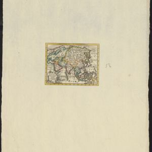
Asia volgens de nieuwste waarnemingen opgesteld
c.1790
Brunei, Cambodia, East Timor, Indonesia, Laos, Malaysia, Myanmar, Philippines, Singapore, Southeast Asia, Thailand, Vietnam
A simple hand-coloured map of Asia, with a cartouche of shell, leaves and plants. It shows that in the late 18th century, the details of New Guinea and Australia (‘Nieuw Holland’) were uncertain.
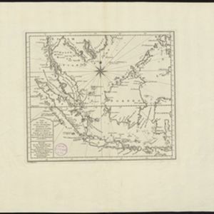
Carte des Isles de Java, Sumatra, Borneo &a. Les detroits de la Sunde, Malaca, et Banca, Golfe de Siam &a.
1773
Brunei, Cambodia, Indonesia, Malaysia, Singapore, Thailand, Vietnam, Philippines
This map shows the islands of Java, Sumatra and Borneo, the straits of Sunda, Malacca and Bangka, and the Gulf of Siam. The title is given in both French and Dutch, as are some of the place names on the map.
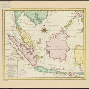

Carte des Isles de Java, Sumatra, Borneo &a. Les detroits de la Sunde, Malaca, et Banca, Golfe de Siam &a.
c.1772-1780
Brunei, Cambodia, Indonesia, Malaysia, Philippines, Singapore, Thailand, Vietnam
This map shows the islands of Java, Sumatra and Borneo, the straits of Sunda, Malacca and Bangka, and the Gulf of Siam. The title is given in both French and Dutch, as are some of the place names on the map.

Nieuwe kaart van het oostelykste deel der weereld, dienende tot aanwyzing van de scheepstogten der Nederlanderen naar Oostindië
1753
Brunei, Cambodia, East Timor, Indonesia, Laos, Malaysia, Myanmar, Papua New Guinea, Philippines, Singapore, Southeast Asia, Thailand, Vietnam
This map of the Eastern Hemisphere was designed to show maritime routes from the Netherlands to Southeast Asia. It shows New Guinea (‘Nieuw Guinee’) and Australia (‘Nieuw Hollande’) as one landmass, connected via an area labelled ‘Karpentarie’.
- Filter from 1596 to 1898
- [remove]Borneo29
- [remove]Sulawesi29
- Java28
- Celebes27
- Malay Peninsula26
- Siam26
- Sumatra26
- Pegu18
- Iava16
- Western New Guinea16
- Ava13
- East Indies11
- more Detailed Location »


