Search

Search Results

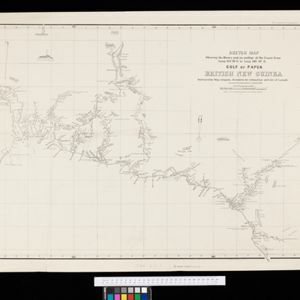
Sketch map shewing the rivers and an outline of the coast... Gulf of Papua, British New Guinea

event1893

location_onPapua New Guinea

Map of part of the east coast of the Gulf of Papua, with river mouths, shoals, bathymetry (water depth). On land, notes on terrain (‘Hills 100 to 150 ft. high’), land (‘Good soil’), vegetation (‘Nipa and Sago Palms’) and people (‘Ipikoi Tribe’).

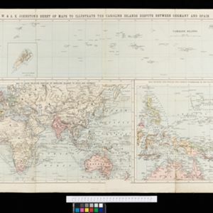
W. & A.K. Johnston's sheet of maps to illustrate the Caroline islands dispute between Germany and Spain

event1885

location_onSoutheast Asia, Papua New Guinea, Indonesia, Philippines, Malaysia, East Timor

Three maps of the Caroline Islands. One shows colonised areas in Southeast Asia: Dutch East Indies; British North Borneo, British New Guinea; German New Guinea; Philippines (Spain); Portuguese Timor. The route of the Challenger expedition is marked.

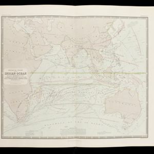
Physical chart of the Indian Ocean: shewing the temperature of the water, the currents of the air and ocean, directions of the wind, districts of hurricanes, regions of the monsoons & ty-foons, trade routes &c&c.

event1849

location_onBrunei, Cambodia, East Timor, Indonesia, Laos, Malaysia, Myanmar, Papua New Guinea, Philippines, Singapore, Southeast Asia, Thailand, Vietnam

Chart of the Indian Ocean, showing climate and weather-related data, including around the seas and straits of Southeast Asia where trade routes are marked, along with monsoon and typhoon regions, and currents during the different monsoon seasons.

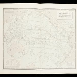
Physical chart of the Pacific Ocean or Great Sea (Mare Pacifico): Showing the currents & temperature of the ocean, the trade routes &c.

event1849

location_onEast Timor, Indonesia, Papua New Guinea, Philippines

Chart of the Pacific Ocean, showing climate and weather-related data, including around the seas and straits of eastern Southeast Asia where maritime trade routes are marked, along with monsoon regions, ocean temperatures and currents.

A chart of the Indian and Pacific Oceans with particular plans of the harbours

event1847

location_onBrunei, Cambodia, East Timor, Indonesia, Laos, Malaysia, Myanmar, Papua New Guinea, Philippines, Southeast Asia, Singapore, Thailand, Vietnam

Southeast Asia is shown on sheets two and three of this 12-sheet map of the Indian and Pacific oceans, including detailed inset maps of the straits of Singapore, Bangka, Gaspar and Sunda, with bathymetry (sea depth), shoals, reefs, anchorages etc.

close

  • Filter from 1847 to 1893

Current results range from 1847 to 1893