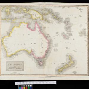
New Holland and Asiatic Isles
1814
Indonesia, East Timor, Papua New Guinea
Includes part of maritime Southeast Asia. New Guinea is labelled as ‘discovered in 1527’—a reference to the Portuguese explorer Jorge de Menezes—with additional labels describing the terrain (‘Very low land’, ‘Coast is not well known’, ‘An Opening’).